Archive for offtrack

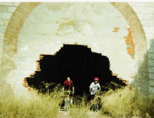
Ride the RailTrails


“Excuse me, señora, could you tell us where the Carrilet is?

Without saying a word, the elderly woman pointed behind us. We turned, and rather embarassed, recognized the stone foundations of a railway bridge right behind us. No roadbed on top, but the foundations were definitely there.


Really, we should have seen it. But that was 1993, our second day of biking an old railbed only partially converted to a bike track and we hadn’t developed the skills that would guide us later on. One thing quickly learned: when in doubt, it was best to ask someone older. Many would remember when the railroad was still in use.

Losing train service is bad news for a town, but now the old railbeds have an alternative use for walking or biking, a use that has gone from marginal to mainline in a very short time, often bringing employment and eco-friendly development to rural areas. Most of these trails are used by locals of all ages – grampa walking for health, ladies out for a Sunday stroll, joggers, kids learning to ride bikes – as well as visitors exploring on foot, by bike or on horseback.

Before thinking “not for me” please read on a bit. Spain’s Vias Verdes have something for just about everyone. They’re a great add-on to other trips as well as a destination of their own: a pre-lunch stroll, access to great scenery or a historical sight, a way to burn off kid-energy. The Vias Verdes are definitely something to keep in mind as you start thinking about upcoming spring holidays.

Rails to rail-trails, a bit of history: Spanish train company RENFE was set up in 1941 to create order in Spain’s chaotic and almost bankrupt. Renfe immediately closed many train lines as unprofitable at that time, then again in the 1960’s – 1980’s as freight and passenger traffic moved towards the highways. In numbers, a detailed 1993 study showed 7,600 kilometers (about 4,720 miles) of unused railbeds.

That’s a significant year: in 1993 the Fundacion de Ferrocarriles Españoles (FFE, Foundation of Spanish Railways) began coordinating the Vias Verdes program to convert the unused railbeds to rail-trails or greenways: tracks for bikers, walkers and horseback riding. Around 1,700 kilometers (about 1,000 miles) have been converted since 1993.

What are the Vias Verdes like? Rail trails are generally not hilly, though some of the old mining railroads have a prolonged grade in one direction or another. Just choose your direction correctly you’ll be cruising downhill.

About 60 of the 93 rail-trails created to date are equipped with bridges, tunnels, signs, kilometer markers, benches for resting and a good surface. Quite a few of these trails are stroller and wheelchair-accessible, appropriate for children who are still wobbly on their two-wheelers. Theoretically on these trails there is no motorized traffic – but in a few cases the trail is used for local traffic.

The remaining trails can be used by the adventurous. Depending on the trail there may be little or no signage, tunnels with no lights, rough surface or navigational issues. These rail-trails are not dangerous but are usually more challenging – and quite possibly more fun for experienced walkers and bikers.
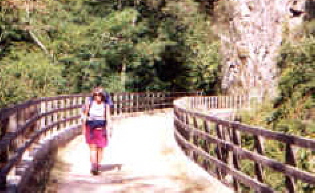
Play detective! While on the Vias Verdes, watch for signs of their rail history, an detective game that’s fun for adults as well as kids. Check out the railbed itself, complete with bridges, embankments and tunnels. Look for old train infrastructure like loading docks, water tanks, signage, freight yards and an occasional tie still embedded in the ground. Notice the “recycled” stations, somehow still train-like but with new uses like bike rental, art or music schools, police or fire stations, hotels, restaurants, libraries, a car wash, bathhouse for swimming pools, churches or even part of a convent.

For more information see website www.viasverdes.com – the English section is pretty good.

For route information, go directly to itineraries / itinerarios link at top left. All trails have basic information on distance, maps, trail surface, and some trails have full route information on accommodations, local fiestas, bike rental, tourism offices (where you could ask about horseback riding). Look for the green leaf on trail listing to see what trails have extra information. Most routes have comments by users (in Spanish), good to check especially if you are less experienced or traveling with children.

Want some suggestions? See below – an asterisk* after the name indicates trails with more route information on website.

Carrilet – I (Girona)* An old mining railroad that also had passenger service. Follows a pretty valley between medieval Girona and Olot. Best parts: Olot – Les Preses and San Feliu de Pallerols –

Amer. A personal favorite, near pretty villages, a lovely natural natural park, Girona city and more.

Terra Alta (Tarragona)* Inland Tarragona, goes through wine country and a convoluted landscape of low mountains. Lots of tunnels, most light up automatically as you enter, but good to take a flashlight just in case. Best part: Bot – Pinell de Brai (in that direction, downhill). From Pinell you can continue on the Baix Ebre rail-trail to Tortosa and then to Amposta on the Ebro Delta.

Senda del Oso (Asturias) An old mining railroad. Spectacular scenery, try to see at least Peñas Xuntas gorge. This rail-trail is usually considered one ove the best in the country. Near Oviedo and several of the Asturian pre-Romanesque churches.

De Pas (Cantabria)* From mountains almost to the sea, this rail trail has Cantabría’s beautiful green scenery. Goes through Puente Viesgo spa town.

Plazaola (Navarra)* Originally a mining railway, later enlarged and lengthened to include passenger service. Pretty mountain route, be sure to travel north for a downhill cruise.

Sierra de la Demanda (Burgos) Another old mining railroad, see the smelting chimneys in Barberillo de los Herreros. The whole trail is pretty, perhaps the best is around Pineda de la Sierra (nice church). This railbed continues north (unsigned) to near archaeological site Atapuerca, discovered when the railroad was built in the late 19th century. The southern end is near various cultural sites in eastern Burgos.

Alberche (Madrid) A Primo de Rivera project that never saw trains, what now remains is from San Martin de Valdeiglesias to Picadas dam. Best part: along the Picadas reservoir, starting by the M501 highway. Not signed but following edge of reservoir no way to get lost. Absolutely flat, nice scenery, a good day trip from Madrid.

Jara (Toledo)* Another Primo de Rivera project, this trail is in western Toledo, between Santa Quiteria and Calera y Chozas. Usually considered one of the best rail trails in central Spain, when traveling north it’s a long smooth downhill, with typical La Mancha-Extremadura scenery. The southern end is near Guadalupe monastery.

Sierra (Cadiz-Sevilla)* Yet another Primo de Rivera project, fully built and never used. Several of the old train stations have been converted to hotels and restaurants, one to a bird-watching center (near Zaframagón bluff, huge vulture colony). Pretty scenery. Near Ronda and the white villages.

Aceite (Jaen)* Southwest from Jaen through a typical landscape of olive groves, with nine iron bridges from the 19th century. The roughly parallel highways would be an interesting back route between Jaen and Granada.

Via Verde trivia
– The first: Senda del Oso and the Carrilet I were both created in 1993-94, Aceite shortly afterwards.

– The most visual: For scenery: my personal choice would be the rail-trails in the green north, other people would choose the more Mediterranean routes in the south and east. For impressive train infrastructure (bridges, tunnels, etc) Del Aceite, la Sierra, de la Jara, Serpis, Plazaola, del Oso are all good choices.

– How a Via Verde is created and managed: The process of creating a rail-trail starts at a local level, usually when a local government contacts the Fundacion de Ferrrocarriles Españoles (FFE) to ask about turning an unused railbed into a rail-trail. In some cases, the FFE contacts local governments to suggest the idea, especially if they’re coordinating a project in an adjacent area. To encourage local governments to consider this idea, the Foundation maintains a pretty good website and does ongoing promotion like conferences and visits to functioning rail-trails.

Once the process starts, the FFE answers questions, gives ideas, helps with viability studies or proposals to get funding. They Foundation doesn’t finance the projects directly, but they help find financing from governmental sources or sponsers. The cost varies tremendously depending on the condition of the railbed, but can easily reach 25,000 euros for a kilometer of trail.

A Via Verde needs to be well designed, useful for local people and a good draw for tourism to make that investment in money and energy worthwhile. Through good planning, good luck or maybe the boom in active travel, most rail-trails are quite successful, bringing recreational options for locals, employment and eco-friendly development to rural areas.

When the rail-trail is completed, the maintenance and management is carried out on a local level. The FFE displays information on the Via Verde website, and acts as a watchdog to be sure the local government fulfills their obligations. If a Via Verde is not managed correctly – unauthorized motorized vehicles on the trails being a big issue, lighting in long tunnels another – the FFE posts a notice on their website, hoping the problems will be solved. Theoretically a trail can be downgraded, which could reduce the number of users and revenue for an area.

Cabo de Gata: Sea and Sun – and lots more


Like sun? Like nature? Like outdoor sports? Like lesser-known destinations, and don’t mind a longer drive or figuring out some transportation options?


Then consider Cabo de Gata, the southeast tip of Spain. Almost desert-dry, with the lowest rainfall in all of Europe, so your chances of warm, dry weather are pretty good most of the year, and there are things to do if the sun doesn’t shine during your entire stay.

So exactly where is this? Between Mojácar (south-ish on Spain’s east coast), and Almeria city (east-ish on Spain’s south coast), and everything east of a line through Níjar connecting the two places – plus a bit north of that line (Sorbas and Tabernas).

Cabo de Gata Natural Park: One of the main attractions of this area is the Cabo de Gata Natural park, declared in 1987. Thanks partly to park zoning, the coast between Mojácar and Almería has mostly escaped excessive development; farther back in time the lack of water also hindered development, so now you can enjoy a relatively pristine coast. “Relatively” pristine, as ironically, the park did bring some rather unfortunate building in urban areas, along with much needed money from increased tourism. Hopefully the park zoning and environmentalist interest will help guide the area’s development in the future.

So what’s to see?

Along the coast

— Villages or man-made: Mojácar, charming white village on a hill overlooking the sea. Agua Amarga (south of Mojácar) and Cabo de Gata (south coast, east of Almeria), two old fishing villages, now developed but still with a bit of old flavor. Cabo de Gata lighthouse on southeasternmost tip, placement and view. Cabo de Gata saltpans, probably used in Roman times and still in operation; saltpans are between lighthouse and village. Almeria city, castle and Cathedral built on site of a 10th century mosque; can see bits of mosque but not as spectacular as Córdoba. Almeria city also has a museum with some archeological artifacts from the area, though the best pieces are in Madrid.

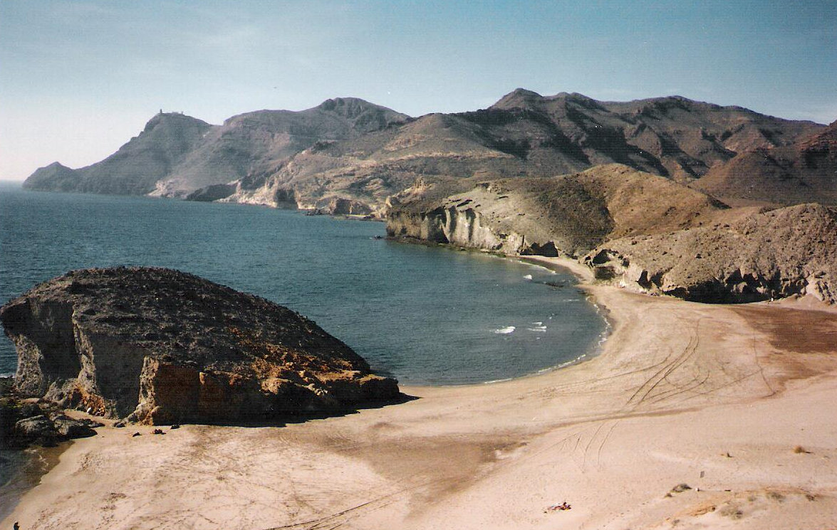
— Nature: View from Mesa Roldan lookout. Rock formations, all along eastern coast but especially between San José and the lighthouse, in the sea and on the beaches. Crater of old volcano, northwest of Los Escullos. Flamingos and other bird life in salt pans near Cabo de Gata village. Sand dunes, especially Playa de los Genoveses. Best beaches: Monsul and Genoveses beaches near San Jose. Agua Amarga beach, small but nice, and beaches south of that village, some only accessible on foot at low tide. El Playazo, near Rodalquilar village. Cabo de Gata village beach is long but rather rocky. Some nice beaches near Carboneras (east coast) but nearby cement factory is a bit off-putting. Mojácar’s beaches are smallish and outside town. San Pedro nudist beach just north of Las Negras (nice walking path to get there, 40 minutes); this used to be a lovely, almost pristine beach but has some issues now –illegal bars, “alternative lifestyle” settlement that is not terribly respectful of the environment.

Inland

— Villages or man-made: Near Tabernes: several US – Western town film sets remaining from the 1950-1970’s era of “paella westerns”, host to stars like Clint Eastwood, Brigitte Bardot, Harrison Ford, Raquel Welch and others. Nijar village, one of largest in the area and typical of inland Almeria. “Norias” or water-wheels to draw water for irrigation from underground, one of the best is in Pozo de los Frailes. Abandoned gold mines near Rodalquilar. Cortijo del Fraile ruins near Rodalquilar, site of the events described in Federico Garcia Lorca’s tragedy Bodas de Sangre (Blood Wedding). Archaeological sites (prehistoric and Roman), interesting for history buffs.

— Nature: Tabernas desert, limestone “karst” formations around Sorbas: at least Aguas and Covadura caves, also some gorges so narrow they look like caves.

Environment / sports: There are lots of opportunities for activities in nature (diving, kayaking, hiking, cycling, horseback riding, caving in Sorbas) BUT please remember this is a natural park in a fragile environment, with permit requirements or restrictions for some activities. As always, leave no litter, and if you see any left by less considerate visitors, perhaps you could do a good deed and pick it up. Information on active travel companies in links below.

Shopping: Traditional crafts include ceramics (often cream and blue, some greens and grays). Rag rugs called “jarapas”: these rugs were often used on beds to protect the bedspread. Woven grass mats and baskets. “Indalo” fertility goddess symbol, a stylized stick figure with outspread arms. Good places for shopping: Níjar, Sorbas, Mojácar, San José.

When to go: October – May, with early June and late September a possibility though with higher temperatures. I have swum in the ocean in December (and don’t consider myself especially fond of cold water). BUT….. If it rains, it (usually) pours: Yes, this is the driest part of Europe, but when it rains, it is often a downpour that can cause flash floods. Notice the number of no-bridge stream crossings, where minor paved or unpaved roads dip down over a gully. Heavy rains can and do fill these empty gullies with roaring rivers (hard to believe but true). If that happens, do not try to drive across what was yesterday a dry gully. Ask locals about alternative routes, or even better, ask local police or Guardia Civil; they’ll be in charge of any rescue operations so give them a chance to stop the rescue situation before it happens.

Best villages to stay: Mojacar, Agua Amarga, Las Negras, Rodalquilar (a little inland), San Jose, Cabo de Gata all have hotels of different styles and prices.

How to get there: By car: Fastest but less scenic: southeast to Murcia, then south through Lorca; this is the best route if you plan to stay in Mojácar or Agua Amarga. Most scenic, more challenging driving: to Granada then south through Sierra Nevada and southeast to Almeria through the Alpujarra mountains on smaller roads (several possible routes). Other transportation: Almería station is centralized for train and bus. Madrid – Almeria is a very long trip, so direct bus not a good idea, but Alsa buses run from Jaen, Granada, Sevilla and Malaga. Renfe has direct Madrid – Almeria train service, usually one or two trains a day, sometimes more April-September (www.renfe.es); alas, the convenient night train seems to have disappeared. Almeria does have an airport, and flights may be cheaper than the train. Many towns in this area are connected to Almeria by bus, so if you don’t plan to move around much, public transportation is possible.

And last but definitely not least, that question you may be asking yourself: Why is this called Cape Girl-kitty? And the answer is: the name doesn’t come from “cat” but from “agate” (semi-precious stone) that used to be found along the coast. And yes, if you know your rocks and you’re really lucky, you still might find an agate or two.
Websites for more information / pre-trip planning: English version not always available or complete.

https://www.cabogataalmeria.com/ Good general site with lots of links, well organized. This would be my first pick. On this site, info on the “Western” towns: http://www.cabogataspain.com/Gata-Nature-Reserve/Activities/Leisure/Western-Village-Tabernas.html

Other sites:
www.cabodegata-nijar.es
www.degata.com

Inicio

http://www.museosdeandalucia.es/cultura/museos/MAL/      Website for Almeria Archaeological museum.

https://www.turismodealmeria.org/prepara-tu-viaje/como-llegar/    Some info on bus lines in the province of Almeria.

More information, once you’re there:
Park visitor’s center: Centro de Interpretación de la Naturaleza Las Amoladeras,
Highway AL-3115, Tramo Retamar-Pujaire Km. 7.

Other places for additional information (park or general tourism), take your pick here: https://www.cabogataalmeria.com/Cabo-Gata/Parque-Natural/Puntos-Informacion.html


Discover Five Towns

ChulillaTown


When’s the last time you took the back road? The slow way from A to B, through villages where “nothing” is going on – just life as usual, but in a setting so charming that you park the car and have a coffee, end up chatting with the locals (no matter what your language skills), buying local wine and cheese, and leaving with notes for a detour to another lovely spot or restaurant two towns away…

Sure it takes longer, but if you can arrange the time, the journey between two points becomes part of your experience, instead of “starting your vacation” when you reach your destination. This is even more noticeable walking or cycle touring – no, slow-track travel is not for everyone, but the discoveries made stay with you forever.

Here are five villages discovered while cycling or walking around Spain. Some have been “discovered” in a larger sense and will sound familiar to intrepid travelers. Others are Huh? unknowns. It was hard to select five – there are lots more on my list of favorites – so these are all north and / or east of Madrid, leaving others for another time.

Distances shown are straight line, just an indication to help you find these places that may not be on less-detailed highway maps. All these villages have at least one place to eat and most more than one – Siurana and Calatañazor can get crowded, Majaelrayo is known for game (in season).

Siurana (Tarragona): About 18 kilometers northwest of Reus, on the edge of Priorat wine area. Tiny Siurana is on the way to nowhere – the paved highway ends there on a high bluff. As you drive up the steep (very steep!) highway, imagine pushing a loaded touring bike up and up and up (gasp. pant). Magnificent setting, quaint old stone houses.

Puentedey (Burgos): About 70 kilometers north of Burgos, just north of highway N232. Small village on a natural stone bridge. Be sure to take path under the “bridge” to see the back view, and for the best photo op, take road up to cemetery. Exploring back roads in northern Burgos will lead to other fun discoveries.

Calatañazor (Soria): About 30 kilometers southwest of Soria. This village was basically a pile of rocks on my first trip, but now many of the old houses have been rebuilt and there’s even an ethnographic museum – try to see a “pinariega” chimney: conical outside, free-standing inside the house. Ruins of a castle, anthropomorphic tombs carved into stone nearby. Ask a local to tell you the rhyme about the name of the village, a musical instrument and a certain Islamic ruler.

Chulilla (Valencia): About 50 kilometers west northwest of Valencia, in the Requena-Utiel wine area. A white village with twisty alleys, set against a reddish cliff with the ruins of a medieval castle. Small, recently renovated spa about 5 kms away (www.balneariodechulilla.com).

Majaelrayo (Guadalajara): about 55 kilometers north-northwest of Guadalajara, west of Ocejón peak. One of the “black villages”, made almost completely of slate with an odd construction technique. Some of the abandoned villages in this rather spooky region are now coming back to life thanks to rural tourism. Majaelrayo is the usual trailhead for the challenging hike up Ocejón; Valverde de los Arroyos (a more classic “pretty village”) on the east side of the peak is also worth a visit.

Kale Tale

Spain. Galicia. Kake

Wheelbarrow of kale

Kale is a super-food, or so they tell us. It’s on that list with blueberries, salmon, quinoa and now (yes!!) dark chocolate.

Now I’m not a real cook, but I do like playing in the kitchen, and my first experience with kale chips was a real revelation (thank you, Betsy).  The problem is finding kale in Madrid.

Sometimes I can get it at the Vallehermoso market.  Then there’s a small fruit-and-veg place in the trendy and health-conscious Chueca neighborhood. There’s even a place not too far from my apartment. But none of these is really reliable, and all require a special and sometimes unsuccessful trip.

It’s different in the north, where kale is food for some kinds of livestock as well as an important ingredient in regional dishes. That includes Galicia, the northwest corner of Spain, where gardens with kale abound along the last kilometers of the Road of St. James (el Camino).

When I say gardens, that can be anything from a two rows to a big field.  It’s not unusual to see knee-high kale next to a stalky kale almost two meters high, so tall you’d think it was another plant altogether.  I’ve always been curious about that tall kale (Camino pilgrims walking with me also ask), but never had the chance to talk to an expert to get the scoop.

Last month I got my chance during first part of Way-Back Camino, walking the Camino away from Santiago instead of towards Santiago.  In a village at the top of a hill on that dang rollercoaster into Portomarin (pilgrims will remember, it’s harder going east!) right on the Camino there was a wheelbarrow piled high with kale and a woman harvesting in her garden. I took a photo of the wheelbarrow as she was coming out with another armful, looking at me with a puzzled expression, um, you like my wheelbarrow?

 So we talked about kale , and I got the scoop.

The knee-high kale was planted about three months ago – March or thereabouts – and the tall kale about a year and a half ago; kale can easily live two years and get taller than hers, so tall that you have to pull it way down to harvest the leaves. No, the frost doesn’t kill it, she says it tastes even better after a freeze, something I’ve seen in kale recipes that require frost-nipped kale. (climate note: it does freeze in Galicia, but temps are rarely below freezing for the entire day, and certainly not below 25ºF for any length of time at all).

She told me that caldo gallego is usually made with kale from late spring to fall, and with turnip greens in the winter.  (A Galician woman in Madrid told me this can be a family thing, as her family always uses turnip greens).

My expert got the kale scoop too  – she was surprised to hear that kale is considered a super-food, and liked the idea of kale chips.  She was shocked that kale is hard to find in Madrid, and that one of my sources told me it’s not the season – she indignantly insisted that it is high season for kale, but we concluded that the clueless Madrid vege vendor was thinking hearty soups, not a summer favorite in Madrid where temperatures are often over 90ºF.

We parted after a nice conversation and some good giggles, sort-of friends. This is just the kind of local encounter that I love and seek out whenever possible – next time I walk through her village I’ll be looking for her to say hi and ask if she tried the kale chips.

 Spanish language tips:

Kale = berza.  Turnip greens =  grelos

Caldo gallego: literally Galician broth, though this hearty soup is anything but “broth”.

Spanish slang: coger una berza (catch a kale) = get drunk


Spain. Galicia. Triacastela

Kale garden Triacastela

Caldo gallego recipes

Caldo gallego is one of those traditional recipes with some basic ingredients and lots of options.  Every Galician cook has a recipe, and most cook by eye instead of by a book; if you want to make caldo gallego here are the basic guidelines:

Must have:  greens (usually kale or turnip greens, also works with spinach or cabbage or a mixture of greens), potatoes, white beans (some kind about ½ inch long)

Optional:  ham, chorizo type sausage, beef, meat stock (meat is not at all necessary to make a fabulous soup).  Some people add onion, garlic or chestnuts.

Lovely thing about caldo gallego? There’s no way to make it wrong.  Well, it’s not wrong as long as you use the three basic ingredients, that watery potato soup with three beans in Triacastela on my last trip was not caldo gallego. What a disappointment!

If you are a by-eye cook, here’s my unscientific, super-simple method. It’s not 100% authentic but pretty close, easy to do and pretty darn good (I like one-pot meals that don’t need watching!).  True cooks who cringe at this method: see real recipes at the end.

Proportion idea per serving (do your own thing if this doesn’t look right):  1 medium white potato, handful uncooked of white beans, about 3 or 4 times volume of potato in uncooked kale.    Make extra, this keeps for several days and heats up well.

Remove the big central vein from the kale leaves and tear into pieces, size not real important but thinking of eating ease perhaps double the size of soup spoon is largest reasonable size.

Cut the potatoes into thick slices (chunks are ok too).

In a deep, heavy pot, get the potatoes started in some olive oil. When they’re a little soft add a bit of garlic or onion if you are using. This is a good time to add the chorizo, so the potatoes get the flavor.

Add the soaked white beans and about double water to cover (or a bit more depending on beans, less if beans are pre-cooked canned type).

Add a bit of salt and a sprinkle of pepper (not really in Spanish recipe but tastes good). Another possible addition: sprinkle of Spanish smoked paprika.

Let that mixture do its thing on medium-low heat for a while, add the greens and let it finish cooking.   How long? Ummm.  Greens need to be totally wilted into the soup, beans done but potatoes not completely mushy. Correct seasoning and serve.

Possible addition:  Chestnuts! Peeled and maybe roasted prior to soup (I can get them prepped like this in Madrid).  I’ve never had caldo with chestnuts in any restaurants, but saw this in a recipe (now vanished) tried it and it’s great; Galician chestnuts are as famous as Galician potatoes.

A recipe in Spanish

www.recetasderechupete.com/caldo-gallego-receta-tradicional-gallega/4365/

 Two recipes in English, they look ok, first more than second

www.tienda.com/recipes/caldogallego.html

http://spanishfood.about.com/od/hotspanishsoups/r/CaldoGallego.htm


Toledo, Offtrack


San Juan de los Reyes


Toledo. (yawn). Too many Toledo visits have you burned out on that destination? Does the idea of another day in that city make you roll your eyes or start wondering if your guests can manage on their own?

Please re-think. Everyone goes to Toledo, often many, many times. But the majority of visitors see only the big-name sights like the Cathedral, Tránsito synagogue, Greco masterpiece in Santo Tomé church, maybe Santa Maria la Blanca synagogue or San Juan de los Reyes monastery.

Does that sound like your own experience? It certainly was mine, until I decided to visit Toledo and not see a single Important Monument. And wow, what a revelation!

This post shares some of the things I found that day and on later “offtrack” visits – this is not an art guide, history book or even an all-inclusive list of off-track sights, it’s just an attempt to get you past that yawn and into some exciting discoveries.

A good strategy for visiting off-track Toledo (or any other well known city): do some reading before the visit, have a sort-of plan but be ready to ditch your ideas if something more interesting comes up. That’s especially true in Toledo, where part of the fun is just wandering – the discoveries made on those wanders are even more special because of the surprise factor.

Here are some off-track ideas, purposely excluding all the big sights.

Jewish Toledo:  The old Jewish quarter merits some serious wandering, down along the river and partway up to the center city.  Two synagogues remain, both converted to churches or other uses after the Jews were expelled in 1492.  The Tránsito (now an excellent museum but as a “major” site not included here).  Don’t miss the “old” synagogue Santa Maria la Blanca, especially if you also visit one of the old mosques:  that gives you an excellent opportunity to compare / contrast and ponder the implications of a synagogue that looks like a mosque or a mosque that looks like a synagogue.

Muslim Toledo: The main tourist track in Toledo completly ignores the few remaining Muslim monuments, check them out to balance your visit to Toledo, City of the Three Cultures.

Mudejar architecture (walk-by noticing). Many of Toledo’s older churches are mudejar style, built by Muslim craftsmen who stayed in Toledo after it was conquered by the Christians. They continued to build in the style they knew well: decorative brickwork, interlocking arches and “onion” or lobulated arches and windows. Sign of the cultural plurality of medieval Spain: no one found it odd to have some Muslim-looking style in a church or synagogue (both synagogues have some Muslim-style decorations).

Cristo de la Luz: When I found this little jewel I was shocked I’d never seen it before. It was built as a mosque in 999 (less than 100 years before Toledo was conquered by the Christians) and later converted to a church, an unusual bit of Muslim culture in the “City of Three Cultures”. Stand to one side to see the scant difference between the original Muslim building and the mudejar-style apse added in the 13th c after it was converted to a church; be sure to look up at the nine cupolas in the original building (now the entrance). Recent excavations uncovered a Roman road in front of this old mosque. Ask someone to tell you the legend about Alfonso VI’s horse (hint: if you’ve done the Wall Walk in Madrid that legend may sound familiar). Location: North side of city, not far from Bisagra gate.

El Salvador church:  Another old mosque converted to church. This one is bigger than Cristo de la Luz. Probably built arount 1041 (shortly before Toledo became Christian again), has some archaeological remains from Visigothic and even Roman periods. The tower is original from the mosque, with belltower added after it was converted to a church.  Go up the tower for a view of neighborhood, and down to left and along side of nave to back for more remains.

Belltower of Santiago del Arrabal church (next to Puerta Nueva de Bisagra): This brick belltower may have been part of a mosque.

Mezquita Tornerias: Remains of a mosque on Tornerias street. Closed for rehab, but ask at tourism office just in case

Upper city: When the bustle of the busy tourist streets starts getting on your nerves, head for this area, with lots of cloistered convents and monasteries. You’ll find yourself walking between high walls with few windows and doors, routed this way and that by cul-de-sacs and tiny squares, sometimes along tunnel-like alleys with buildings over the streets (the “cobertizos”). Some of these convents have art collections, but schedules tend to be quite short so they may be hard to visit. But even without those visits a long walk in this part of town gives an entirely new vision of Toledo – and it’s usually almost empty.

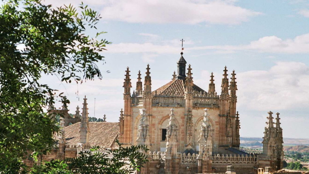
With a map and a good sense of direction, you can find the Virgen de Gracia lookout, right over San Juan de Reyes monastery (see photo above). At the top of one of Toledo’s many hills is San Román church, now the Visigothic museum. Toledo was one of the most important cities under the Visigoths (aprox 450 – 711 AD), but these remnants and a few architectural bits and pieces are almost all that is left from that time. Location of the cobertizos : northwest of the Cathedral: find San Vicente church (go inside for a surprise) then along narrow alley to the left of church to Santa Clara square, around lower part of Santa Clara with retaining wall on your left, under the cobertizo and turn left at cross street under next cobertizo, then wander with map in hand.

Toledo City gates: Seeing a few of the gates will help you appreciate the importance of Toledo’s walls and the different periods of this ancient city. Most people only see the New Bisagra gate and the Arco de Sangre – get beyond that with the Cambrón gate, near San Juan de Reyes and the Valmardon gate near Cristo de la Luz mosque. The first has a good view over the plains and a space between the inner and outer doors with a fun sign; the second gate was from the original walls and ended up inside the city when new walls were built farther out. My two favorite gates are the old Bisagra gate (to the right of the New Bisagra gate when outside the city) and the Alcántara gate and bridge. Alcantara bridge was originally Roman, rebuilt several times, the gate Muslim as shown by the double-dogleg entrance. The gate is one of prettiest in the city, and you or your kids can climb up to part of the walls (note: this gate is close to the train station).

What else? In addition to all this, there are other sights not always on the “biggie” list: Museo de Santa Cruz (off the Zocodover), with a good permanent art collection and good temporary exhibits. Roman ruins, in-city the baths in Amador de los Rios square (signage and lighting could be improved but interesting as contrast with other periods), other ruins a bit farther out. San Ildefonso (Jesuitas) church in Plaza Juan de Mariana – go up the tower (no elevator) for an amazing view of Toledo. If you can’t face the climb, view from front door is pretty good. And last but definitely not least, El Greco house and newish museum (near the Tránsito synagogue, never really Greco’s house but a representative house of that period.

Important tips for your Toledo visit: The only way to really see Toledo is walking, so be sure to wear the right shoes – it’s no fun to stop exploring just because your feet hurt, while the rest of your body and brain are raring to go. Seriously: no flipflops or heels! Best is something with thick soles between you and the knobbly pavement. If you are at all unsteady on your feet or have knee problems, think about taking something to keep you upright – I’ve seen travelers in Toledo using hiking poles in the city, which is probably a good idea, given the cobblestones and the constant ups and downs. Get a good map, and take a small compass. Toledo’s streets are winding, and there aren’t a lot of streetsigns.


Madrid, Offtrack: M. Tiflológico

MadridTiflologico

Not far from Cuatro Caminos lies one of Madrid’s secret museums: the Museo Tiflológico.

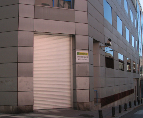
Perhaps the tongue-twisting name has something to do with the unknown status of this place. Or maybe it’s the somewhat hidden location, several floors up from street level in a nondescript building, on a side street off Bravo Murillo, well away from the usual museum circuit, with very little signage in the street. Whatever the reason or reasons, even long-time local residents are unaware of this museum.

So what is this place?

The Tiflologico is run by the Spanish National Blind Organization (ONCE), which many locals know mainly from the telephone booth-sized kiosks selling ONCE lottery – or lottery sellers on street corners. Fewer people are aware of the large ONCE training center in the north part of the city or the other ONCE buildings in Madrid. Even fewer know that the ONCE organization also helps people who are not completely sightless, and some people with other kinds of disabilities.

The museum was inaugurated in 1992, with four main sections:

Reading, writing and teaching tools for the blind. Explains the raised-dot Braille system for reading and writing and shows the tools used over the years, plus other tools for learning to be functional in a sighted world (Braille typewriters, “talking” books, calculators…). Lots of exhibits of tools used as well as explanatory text. This section is actually the largest of the four sections, quite educational and gives the museum its name.

Temporary exhibits: Often quite interesting (I discovered this museum thanks to a temporary exhibit), usually artwork by blind or visually impaired artists. The museum often buys or keeps a piece on loan after these exhibits.

Permanent exhibit of art by the blind: With artwork that would be considered very good even among sighted artists, the quality and diversity of art in this section may change your ideas about the artistic capacities of sightless people. Some of my favorites are the blue tapestry, the chestnut seller sculpture, and a painting showing a rainy street scene – not to mention the sculptures in the entryway.

Models: Thirty-six scale models of major monuments in Spain and the rest of the world: Madrid’s Alcala gate, Santiago de Compostela’s Cathedral, Fromista’s Romanesque church share space with Rome‘s Coliseum, the leaning tower of Pisa and the Taj Majal. These models are partly a teaching tool for the blind, but are fascinating for the sighted as well, giving a bird’s-eye view of monuments that cannot be fully understood at street level or inside. A few models may be on loan out of the museum, but the majority will always be there.

All in all, a great place to see, for the artwork and the monuments, which are a fun “visit” to sights in other cities.

Museo Tiflologico (located in the ONCE bibliographic building)
website: http://museo.once.es/home.cfm Email: museo@once.es
calle Coruña 18 Metro stop: Estrecho
Usual schedule: Tues-Fri 10AM-2PM, 5-8PM, Sat 10AM-2PM, closed Sun+Mon
Note: Take your ID or a photocopy, you may be asked to fill out a short form before entering the museum.